
Autonomous drones are suitable for industrial inspection when the inspection task is repeatable, the operating environment can be sufficiently characterized, and the resulting data can be trusted within the organization’s maintenance and quality-control process. They are not a universal replacement for rope access, ground-based non-destructive testing, or a remotely piloted aircraft with an experienced operator making real-time decisions.
The decisive distinction is not whether a drone can fly without a pilot continuously moving the controls. It is whether the system can safely complete a defined inspection mission, acquire evidence of adequate quality, detect conditions outside its planned envelope, and hand its findings into an accountable engineering workflow. In aerospace, airport, energy, logistics, and heavy industrial environments, these requirements are more demanding than simple autonomous navigation.
For scheduled visual surveys of known assets—such as aircraft exteriors, hangar roofs, storage tanks, runway lighting corridors, or repetitive structural bays—autonomy can reduce setup time and improve inspection consistency. For damage assessment after an unusual event, work close to reflective or moving surfaces, or inspections that require a technician to interpret ambiguous indications in real time, human-directed operations remain more appropriate.
Autonomy is not the same as unattended inspection
Industrial drone offerings are often described as autonomous even though they operate at very different levels of independence. A waypoint mission flown under continuous supervision is fundamentally different from a system that plans its own route, avoids obstacles, identifies defects, and decides whether another pass is needed.
That difference matters because each additional decision transferred from a human operator to software introduces a separate validation question. Can the system localize itself accurately around a complex structure? Can it distinguish a safe clearance from a collision risk? Does it recognize that glare, rain residue, a shadow, or a repair patch has degraded image quality? Can it identify a change from baseline without generating an unmanageable number of false alerts?
For most industrial applications, the commercially practical model is supervised autonomy: a drone executes a preconfigured route and captures standardized data, while a qualified operator retains responsibility for mission supervision and intervention. The inspection result is then reviewed by an appropriately authorized engineer, inspector, or maintenance organization. This model captures much of autonomy’s value without assuming that flight-control software or computer vision can independently make an airworthiness or asset-integrity decision.
Where autonomous missions create a clear operational advantage
The strongest case is a controlled, recurring inspection with stable geometry. A system that can repeat the same trajectory, camera angle, focal distance, lighting approach, and data naming convention makes comparison between inspection cycles much more reliable. This is particularly useful where the inspection question is change detection rather than one-time observation.
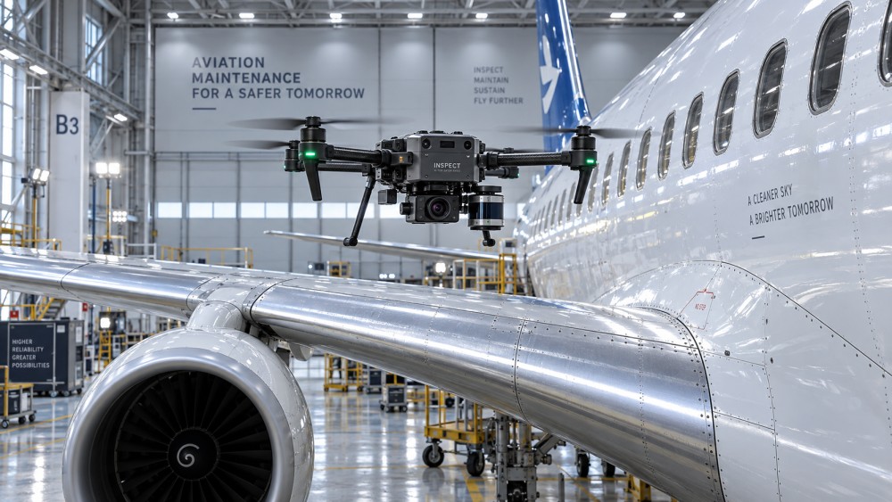
Aircraft exterior surveys illustrate the point. High-resolution imaging can document the condition of a fuselage, wing leading edge, empennage, radome, access panels, or selected landing-gear areas without repeatedly positioning lifts around the aircraft. For composite fuselage sections, the drone can create a repeatable visual record of surface finish, paint damage, impact marks, sealant condition, or visible delamination indicators. It cannot, by visual imaging alone, establish the absence of subsurface damage. A finding that appears suspicious may still require tap testing, ultrasonic inspection, thermography, or another approved non-destructive test method.
Autonomy also has value when access creates disproportionate exposure or disruption. Inspections at height, over water, around confined infrastructure, or within large facilities can otherwise require scaffolding, cranes, elevated work platforms, shutdowns, and exclusion zones. A drone does not remove all site controls, but it can reduce the frequency with which people must enter the highest-risk access positions.
At airports, a carefully governed drone programme may support perimeter, roof, façade, drainage, lighting, pavement, or equipment inspections in locations where airside access is already tightly controlled. The operational benefit is not simply flight speed. It is the ability to capture geolocated, time-stamped evidence without converting every observation into a manual access exercise. Yet airport environments also impose some of the strictest constraints: communications discipline, runway protection, bird activity, electromagnetic interference, vehicle movements, and proximity to crewed aircraft all limit where and how a drone may be used.
The comparison that matters: repeatability versus adaptability
Autonomous and manually piloted drones should not be treated as opposing categories. They solve different inspection problems.
The central trade-off is simple: autonomy improves repeatability, while skilled human control improves adaptability. A mature programme uses each where it is strongest. Treating autonomy as a way to eliminate human involvement is usually a category error. The human role shifts from continuously controlling the aircraft to designing missions, approving operational limits, validating data, managing exceptions, and making maintenance decisions.
Sensor reliability determines whether the flight has inspection value
A drone can complete a flawless autonomous route and still produce unusable inspection evidence. Image quality depends on more than camera resolution. Standoff distance, lens selection, shutter speed, stabilization, illumination, surface reflectivity, viewing angle, atmospheric conditions, and the ability to maintain focus all affect what can be identified.
This is especially important for aerospace materials. Carbon-fiber composite surfaces can produce reflections that obscure fine surface indications. Curved fuselage panels and wing structures challenge image geometry. Metallic fasteners and painted surfaces can create contrast patterns that computer-vision models mistake for defects. Hydraulic components in landing-gear areas may be obscured by shadows, contamination, hoses, or restricted viewing angles. A useful inspection specification should therefore describe the defect types of concern and the minimum evidence needed to evaluate them, rather than merely requiring a particular camera specification.
Thermal, LiDAR, multispectral, ultraviolet, and other payloads can expand the inspection scope, but they also add calibration and interpretation requirements. Thermal imaging, for example, may help identify temperature anomalies or support certain composite inspection workflows under controlled conditions. It is not a generic substitute for an approved NDT procedure. LiDAR can improve geometry capture and navigation but may not resolve surface defects of concern. Payload selection should follow the defect mechanism, not the attraction of a more complex sensor stack.
Computer vision requires the same discipline. Algorithms can prioritize images showing corrosion, missing fasteners, coating anomalies, or foreign-object debris, but an alert is not automatically a finding. The model’s training domain, image quality, false-positive behavior, false-negative risk, and performance on the actual asset configuration all matter. In high-consequence maintenance environments, AI is better positioned as a triage and consistency tool unless its use has been specifically validated for the intended decision.
Navigation around industrial assets is harder than open-area flight
Global Navigation Satellite System signals may be weak, blocked, or distorted near buildings, steel structures, hangars, bridges, vessels, and aircraft. A platform intended for close-proximity inspection needs more than GNSS waypoint capability. It may require visual-inertial navigation, LiDAR-based mapping, optical flow, ultra-wideband positioning, or another method of maintaining accurate position when satellite signals are unreliable.
Obstacle avoidance also needs careful interpretation. It can prevent a drone from flying into a large wall or beam, but it may not reliably detect thin wires, antenna elements, pitot probes, cables, protruding fasteners, or polished surfaces that confuse optical sensors. In aviation maintenance, a near miss is not an acceptable substitute for a contact event: rotor wash, dust, loose debris, or an accidental strike can create contamination, foreign object damage, or operational delay even if the drone remains airborne.
For this reason, close-range autonomous inspection needs defined clearance rules, restricted flight volumes, asset-specific digital models where practical, conservative abort logic, and a clear transfer-to-manual procedure. The safest mission is often not the one with the shortest path. It is the one that preserves adequate sensor standoff and creates predictable recovery options when localization confidence falls.
Compliance is an operational design constraint, not a paperwork stage
Regulatory requirements depend on jurisdiction, airspace, aircraft mass and configuration, operational category, visual-line-of-sight conditions, proximity to people and infrastructure, and the nature of the mission. In many jurisdictions, the operator—not the drone manufacturer—must demonstrate that the proposed operation is authorized and that operational risks are controlled. Beyond visual line of sight, flights near airports, automated docking, operations in restricted areas, and certain night or proximity missions can introduce additional approvals or conditions.
For aviation-related work, drone compliance and aircraft airworthiness are separate questions. A drone may be legally operated under an applicable unmanned-aircraft framework, yet its inspection output may still be unsuitable for release-to-service, continuing-airworthiness, or maintenance-record purposes unless accepted within the relevant maintenance procedures. A photograph of a component is not equivalent to an inspection sign-off. The responsible organization must determine how the data is reviewed, retained, linked to asset identity, and escalated into an approved maintenance action.
Data governance is equally important. Inspection imagery can reveal aircraft configurations, security layouts, production details, infrastructure vulnerabilities, or customer-controlled assets. Procurement should examine encryption, user access controls, data residency, cloud processing arrangements, retention rules, audit logs, exportability, and the supplier’s ability to support an investigation after an incident. A low-cost flight platform can become expensive if its data environment cannot meet contractual or security obligations.
What to test before committing to a fleet or inspection programme
The appropriate evaluation is a mission acceptance exercise, not a generic demonstration. The selected platform should be tested on representative surfaces, in realistic lighting and weather limits, with the intended payload, around the actual obstacle environment, and against predefined inspection questions. The key output is evidence quality: whether images or sensor readings allow an authorized reviewer to make the intended assessment with the required confidence.
Mission repeatability should be measured in practical terms. Can the system revisit the same area with enough positional and imaging consistency to compare records? What happens after a software update, a camera replacement, changed lighting, or an asset configuration change? How are route revisions controlled? If an automated docking station is proposed, what checks confirm battery condition, sensor cleanliness, communications integrity, and safe launch conditions before each flight?
Failure handling deserves as much scrutiny as nominal performance. Relevant scenarios include lost link, degraded positioning, low battery, unexpected personnel entry, wind gusts, obstacle-detection uncertainty, payload malfunction, and incomplete data capture. A system that simply returns home after an interruption may be unsuitable if the return path crosses a sensitive work zone or if its inspection record does not clearly identify which locations were missed.
Supportability also affects industrial suitability. Battery supply, spare propellers, payload repair, calibration, software version control, cyber patching, operator training, and availability of local technical support all influence the true continuity of an inspection operation. Where inspections feed maintenance planning or production decisions, an unavailable drone system is not merely an inconvenience; it can become a scheduling risk.
A practical boundary for adoption
Autonomous drones are most credible when they are assigned a narrow, well-specified job: repeat this route, maintain these stand-off distances, collect this type of data, and notify a human when confidence or conditions fall outside the approved range. That boundary is not a weakness. It is what makes reliable automation possible.
They are less suitable when the inspection task depends on judgment that cannot be fully specified in advance, access conditions change continuously, or the consequence of a missed indication is too high for the available sensor and validation method. In those cases, drones can still improve access and documentation, but they should operate as tools under direct expert control rather than as independent inspection agents.
The investment case should therefore be built around validated coverage, data usability, and avoided access exposure—not around the claim that autonomy alone replaces inspectors. When the mission is repeatable and the governance is mature, autonomous inspection can become a dependable part of an industrial maintenance system. When those conditions are absent, a manually operated platform or conventional inspection method may deliver a more defensible result.